
blah blah blah
Parker Mountain
Length: 3.6 miles out-and-backDifficulty (click for info): Easy
Elevation Gain: 550 feet (+270 feet on return)
Rating (click for info): 5/10
Elevation: 1407'
Prominence: 725'
Driving Directions:
Trailhead and parking area are located on Rt. 126 in Strafford, NH. Look for two pull-offs on the west side of the road, 2.5 miles northwest of the junction with Rt. 202A and 7.1 miles southeast of Rt. 28. Avoid the northern one, which has a mailbox and a private dirt drive, and park in the southern one. Click here for a Google map.
About the Hike:
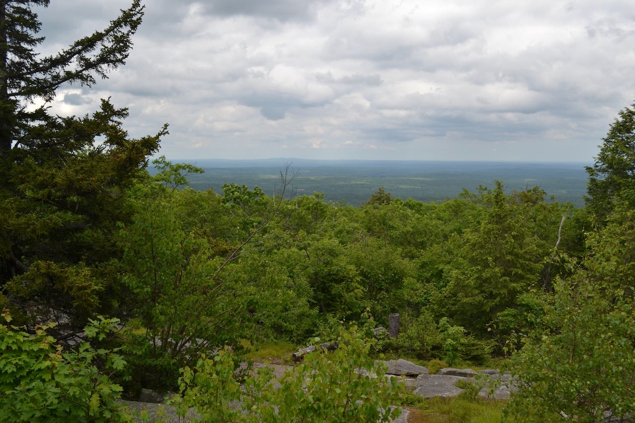
Parker Mountain, with a modest altitude just over 1400', is the highest point in the Blue Hills, a string of low mountains in the southeastern Lakes Region. The range is most famous for the fire tower on Blue Job Mountain, but other hiking trails exist in the area, like the Strafford Town Forest trails on Parker Mountain. Though it can't compete with the above-ground panorama from the fire tower, several fine ledges along the lengthy summit ridge of Parker have some unique and enjoyable views, especially those on the southwest end, which overlook Bow Lake. There's a little rough terrain getting up to the top, but it is a mostly easy walk that takes in some scenic environments, including meadow-like open ledges with stands of red pine.
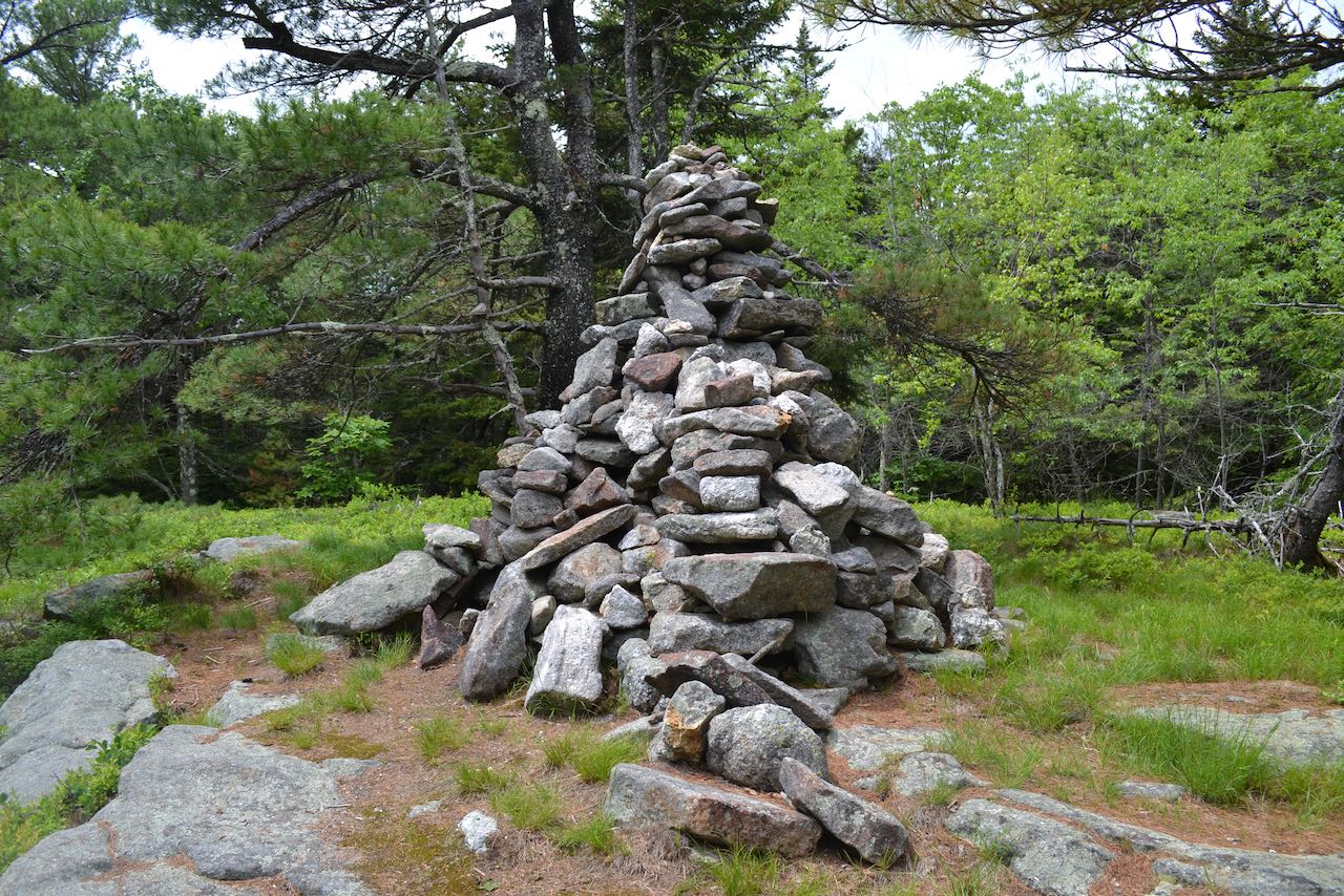
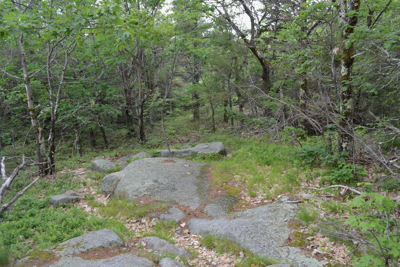
Starting at the sign, follow the Spencer Smith Trail into the woods past a gate. The wide track rises uphill mildly for 0.2 miles, then shoots up the hillside more aggressively. After another 0.1 miles, an opening appears on the left providing a modest view out to the east. Continuing to grind uphill, the trail becomes washed-out in several sections, where foot traffic has beaten out paths around the worst of it. After just another 0.1 miles, the rough climbing is already over and the trail levels off atop the lengthy plateau leading north from the summit. Enjoy the easy stroll along the crest, with intermingled forest and ledges. The trail soon passes through a sparse opening carpeted with blueberry bushes. Ragged red pines characterize the environment. You can see more limited views to the east and southeast once again. Continuing to be level, the trail goes through some more wooded areas, and then ledges dominate again as the trail comes up on an intersection in a clearing after 0.4 miles over the crest. You have a more open view from here. Link Trail joins from the left here; turn right and continue on Spencer Smith Trail. 0.35 miles through intermittent ledges, grassy areas, and hemlock stands follows to reach the summit, where you will see a large cairn.
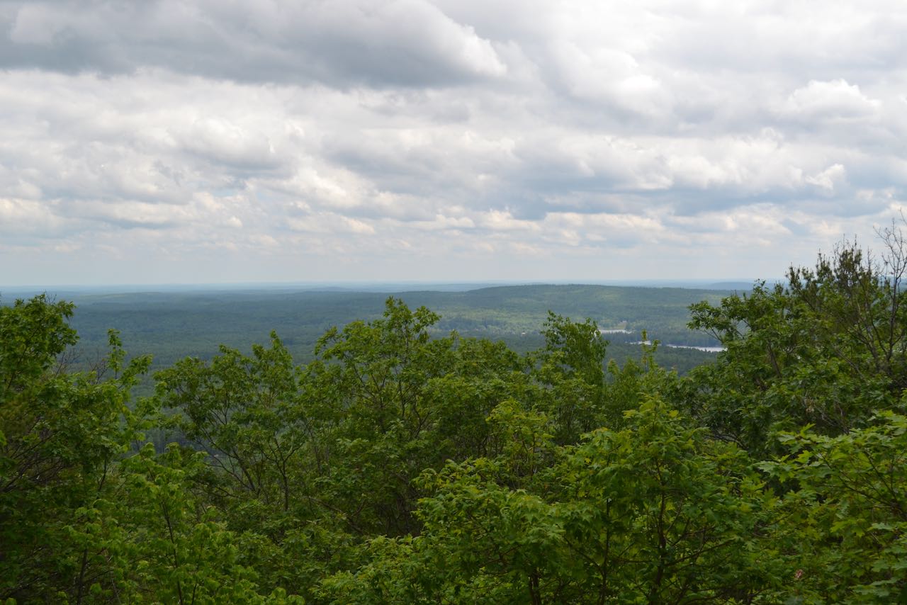
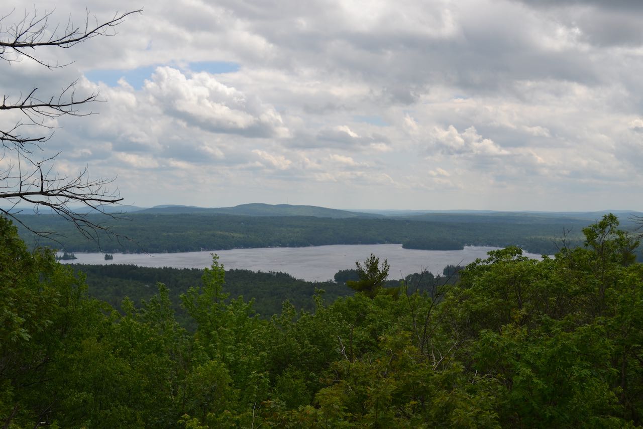
Continue beyond the summit and begin descending the other side of the mountain. In 0.1 miles, the trail passes through one large ledgy clearing followed soon after by another. A quarter mile down from the top, the trail swings to the left and runs across the ridge to another ledgy area. It then turns back to the right and takes gradual terrain down for the last 0.35 miles to the "South Ledges". Views begin to appear as you approach the steep edge of the ridge, and then the best views open when you arrive at the wide open viewpoint. A great view over Bow Lake is had here. The closest hill behind the lake is Saddleback Mountain, and behind that to the left are the three Pawtuckaway Mountains. If you look to the right of the lake in the distance, you can see Mt. Wachusett over in Massachusetts.
Printable directions page